
Hamilton Township ZIP Coverage
Hamilton Township materials document ten ZIPs or postal labels, but the sources do not provide a street-by-street municipal ZIP atlas. The table records what the source supports, not a claim that every listed code lies wholly in the township. Postal geography can cross municipal edges, serve a facility, or reflect survey and service reach. A ZIP code is a useful way to standardize and group an address. It is not a substitute for the municipality field, map sheet, block, or lot.
| ZIP | Hamilton Township source support | Postal or service context | Verification note |
|---|---|---|---|
| 08609 | Municipal building and health or survey materials | Trenton-area mailing | Confirm with Hamilton map, GIS, tax, or Clerk record |
| 08610 | Animal Shelter and health-survey material | Hamilton/Trenton-area | Postal code may cross municipal edges |
| 08611 | Community health survey mention | Trenton-area | Survey mention does not establish township-wide coverage |
| 08619 | Police, court, and service-report material | Hamilton/Trenton-area | Check the physical municipality |
| 08620 | Health survey and annual report mention | Service/respondent geography | No exact Hamilton share was isolated |
| 08629 | Health survey and annual report mention | Border or service clue | Confirm through tax maps or GIS |
| 08650 | Municipal and county mailing examples | Mailing or institutional context | Confirm the exact address and parcel |
| 08690 | Health survey, annual report, and township material | Hamilton-area service context | Do not infer the full code is Hamilton Township |
| 08691 | Health survey and annual report mention | Service/respondent geography | Exact coverage was not located in an official boundary file |
| 08501 | 2024 annual-report service list | Allentown-area postal context | Verify municipality before using it as a location clue |
Hamilton Township’s official addresses show why the distinction matters. The municipal building uses 08609, Police and Municipal Court pages use 08619, and the Animal Shelter uses 08610. Those examples document postal variation, not separate township boundaries.
Hamilton Township Postal Service Set
The 2024 Health, Recreation, Senior, and Veterans Services Annual Report lists 08619, 08690, 08610, 08620, 08629, 08691, 08501, 08609, and 08650 among its service or respondent ZIPs. A separate community health survey also mentions 08611. These materials are helpful as a documented local set, especially when testing an address form or a historical label. They are not a population count and cannot assign every person or every street in a listed ZIP to Hamilton Township.
The health survey reported respondent distributions for several codes, including 08610, 08619, 08690, and 08620. Those percentages describe survey respondents. They do not establish where township boundaries run or how many residents live within each postal area. Preserve the report year and label the material as aggregate planning context when it is used with a parcel or municipal record.
Note: A ZIP listed in a Hamilton Township report can show service reach or respondent geography without showing legal municipal coverage.
Hamilton Township ZIP Lookup Fields
The USPS ZIP Lookup is the correct first stop for delivery standardization. It offers By Address, By City and State, and Cities by ZIP modes. In address mode, company is optional, street is required, apartment is optional, city is required, state is required, ZIP is optional, and Find submits the request. Use it to resolve a street suffix, postal city, delivery ZIP, or ZIP+4 before moving to local parcel records.
| Company | Optional field for an address lookup; the result does not establish an association with a person or organization. |
|---|---|
| Street | Required address field used to return a standardized delivery form. |
| Apartment | Optional field that may be needed when more than one address is a match. |
| City and state | Required in address mode and useful for checking postal labels. |
| ZIP and ZIP+4 | Optional ZIP input can refine an address; ZIP+4 is delivery precision, not a parcel key. |
USPS says that its standardized result does not confirm a person or company at an address and does not provide a guarantee. Use the returned form as a postal reference only. Hamilton Township maps, New Jersey GIS, the Tax Assessor, and Mercer records supply the municipality and parcel checks that follow.
Hamilton Township ZIP Code Map Check
Insider tip. When an address falls near a postal or municipal edge, compare the municipality field, map sheet, block, and lot before choosing a ZIP result as the final location. The Hamilton Township maps index includes tax-map index sheets, zoning, flood-prone, election-district, fire-district, and road maps. These sources help identify the correct parcel context, but a map sheet is not a deed or survey.
New Jersey GIS parcel documentation supports address, county, municipality, block, and lot searching, with PIN matching PAMS. The parcel polygon is for orientation and may not edge-match perfectly. For a current property record, use the tax-map path and Assessor route. For an identified land instrument, use the Mercer County Clerk. Each source answers a different part of the ZIP code directory question.
The Hamilton Township maps page is the documented entry point for tax, road, zoning, district, and other local map references.
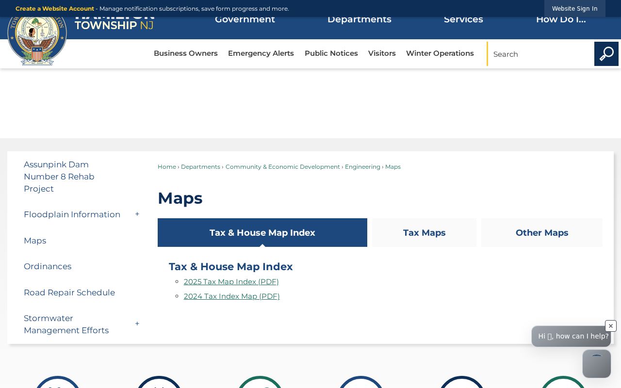
Record the map-sheet revision or year with the address search, then compare it with the parcel identifier rather than relying on a postal label alone.
Hamilton Township ZIP Directory Labels
A modern ZIP is not always the best index term for historical work. Directories and phonebooks can use Hamilton Square, Mercerville, Trenton Suburban, Nottingham, a postal city, a rural route, or a street name. Test those labels beside the address, then record the directory year and publisher. The 1920 Trenton directory index includes Mercer County outside Trenton, rural free delivery, and farmers, which can help with a Hamilton-area household absent from a Trenton ward or street listing.
Historical labels also need a date check. Nottingham was renamed Hamilton in 1842, so an older document may use a correct name that is not the current municipal filter. For a historic map clue, the Library of Congress 1875 Mercer atlas can identify a farm, road, or landowner context. It should be followed by a dated deed, tax, or directory source, not treated as current parcel or household evidence.
Hamilton Township ZIP Search Sequence
There is no documented ZIP-only resident roster for Hamilton Township, and official parcel documentation did not expose a ZIP filter in New Jersey GIS. The useful method is therefore address-first and ZIP-aware. It checks the postal form, then asks the municipal or county record that actually carries the legal geography or recorded interest. Once the ZIP has narrowed an address, the street-level path belongs in the Hamilton Township street directory.
- Run the complete address through USPS and retain the standardized street suffix, city, state, ZIP, and unit detail when needed for delivery matching.
- Search Hamilton Township maps and NJ GIS by municipality and address, then record the map sheet, block, lot, and parcel identifier.
- For a border result, compare the parcel municipality field and legal description instead of selecting a city from a postal autocomplete list.
- Use the ZIP as a cross-reference in dated directories, health reports, or municipal service material, preserving each source’s year and scope.
- For an ownership or instrument question, use the known parcel fields in Mercer Official Records and read the party role, document type, and date.
If a ZIP-only attempt finds no parcel, widen by street and municipality. The code may be a postal, institutional, border, or service label, and the research did not locate a complete official crosswalk from every Hamilton Township street to a municipal ZIP assignment.
Hamilton Township ZIP Directory Searches
ZIP information needs more than one access channel. Online, USPS standardizes the address, Hamilton maps and NJ GIS orient the parcel, and the Mercer Official Records search supports town, block, lot, legal-description, party, date, instrument, and book/page research. In person, the Mercer County Clerk’s Records Room allows researchers to inspect the index and obtain copies of identified instruments. The Clerk can explain the computerized index but does not perform a title search.
For a current assessment or tax-map reference, contact the Hamilton Township Tax Assessor by exact address or block and lot. Mercer’s ordinary public Property Information Portal is closed because of Daniel’s Law, so the Assessor and Clerk remain the documented local alternatives. A precise municipal request should state the address, municipality, block and lot if known, record type, time range, and preferred delivery. Hamilton OPRA handles municipal records, while court records use separate Judiciary procedures.
Library and archival channels provide the dated postal-label layer. Hamilton Library, Trenton Public Library, the State Library, and the Trenton Historical Society hold or point to directory collections, shelf material, scans, microfilm, or research assistance. Ask the repository how a specific volume can be consulted before treating a directory label as an address conclusion.
Hamilton Township ZIP Myth: Boundary
Myth. A ZIP result proves that the address lies inside Hamilton Township. The documented examples point the other way: Hamilton Township official pages use different postal ZIPs, and the 2024 report includes 08501 alongside several 086-area codes. Postal city, sectional-center routing, and service geography can cross ordinary municipal assumptions. A routing label can be useful for mail, but legal jurisdiction comes from the municipality and parcel records.
Mercer County’s 086-area routing context is not a Hamilton Township boundary map. For a property or civic record, verify the exact municipality and county through a tax map, GIS result, Assessor record, or Clerk instrument. For a historic listing, preserve the directory’s own postal or village label and compare it with the dated map and legal description instead of modernizing it without evidence.
Hamilton Township ZIP Code Limits
Postal geography has clear limits. A ZIP+4 narrows delivery sorting, not a block or parcel. A post-office-box ZIP can be associated with mail delivery rather than a physical situs. A unique ZIP may serve a single organization or delivery arrangement, and a carrier route is a delivery sequence rather than a municipal boundary. Hamilton Township research did not locate a complete official street-by-street ZIP crosswalk, so a ZIP should remain a validation field, not a stand-alone proof of location or identity.
- ZIP code
- A postal routing code used to organize mail delivery; it can cross municipal boundaries.
- ZIP+4
- An added delivery-precision segment returned for an address, not a parcel or block identifier.
- PO-box ZIP
- A postal code associated with post-office-box delivery that may not describe a physical situs address.
- Unique ZIP
- A code used for a particular delivery arrangement or organization; do not assume it identifies a township area.
- Carrier route
- A mail-delivery sequence that helps route mail but does not establish municipal jurisdiction.
Address caution. Use Hamilton Township ZIP information for lawful address standardization, family-history research, property context, and focused records requests. Do not use a postal result to infer a protected address or to stalk, harass, intimidate, or harm anyone.
Note: Keep the source, date, postal label, municipality result, and parcel reference together whenever a ZIP result is used in research notes.